They say the best way to truly know a place is to walk it—and Donoussa seems to agree! Whether you arrive as a wanderer or simply curious, she invites you to explore her world through a well-marked network of five trails, plus hidden off-road gems. Just grab a hat, take some water, and set off on your adventure
If again walking isn’t enough and you’re ready for a challenge, how about a Trail Running Race? Every mid-October, our Cultural & Environmental Association “Poseidon” hosts a mountain run that’s become a beloved tradition. This 20-kilometer course takes you over mountain peaks, through charming villages, and rewards you with breathtaking views of the endless Aegean.
Not up for walking or running? No problem—but how about a dance? Summer in Donoussa is full of chances to join the celebration! The grand festivals of Panagia on August 15th, the Holy Cross on September 14th, and our favorite, Agia Sofia’s in Mersini on September 17th, are waiting for you. All you need is a good mood and your brightest smile—no dance skills required!
A MUST BEFORE YOU LEAVE
BOAT TRIP
In the meantime, don’t miss a ride on the local boat “Donoussa Magissa” for an unforgettable trip around the island or even to the nearby Makares islets, weather permitting. With Captain Elias at the helm, his lively spirit and great music will have you wishing the journey never ends!
And if, in the end, you’d rather do nothing, then truly do nothing. Forget the clocks and to-do lists, sink into your favorite beach, sip your drink of choice, and get lost in a book from the island’s wonderful lending library. Just breathe, unwind, and enjoy—because why not?
OUR BEACHES
DIVE RIGHT FROM THE PORT
STAVROS
The first beach you see—even before stepping off the boat. Just a five-minute walk from anywhere in Stavros, it’s always there, waiting for you to dive right in. No second thoughts, just crystal-clear waters calling your name.
THE OLD SHIPWRECK
KEDROS
What’s a 20-minute walk when it leads to one of the island’s most iconic beaches? A place of history and beauty. As you descend the scenic stone path, you’ll spot the remains of the World War II destroyer warship “Orion”, resting beneath the waves. Grab a mask and flippers for an underwater adventure. And when you’re ready to unwind, the beachside bar-restaurant awaits with shade, coffee, food, and drinks.
THE ANCIENT BEACH
VATHI LIMENARI
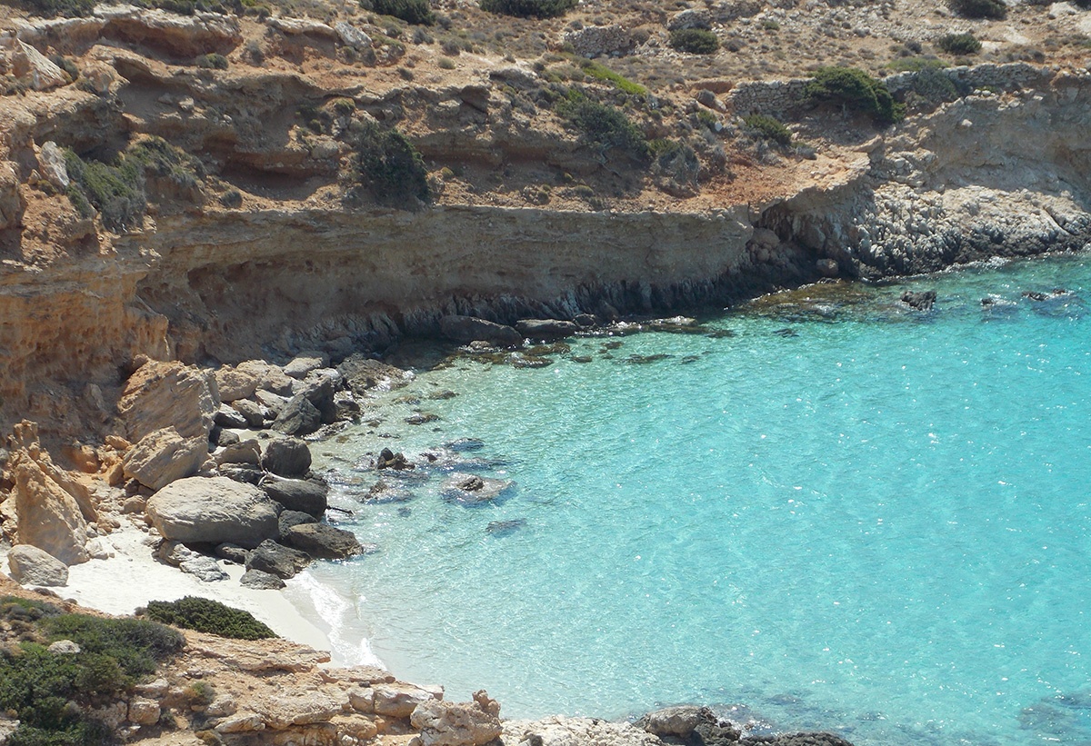
Pebbles, serenity, and endless azure blue waters. Nestled below the half-crumbled windmill of Mesaria, this hidden gem awaits—just a 35-minute walk from Kedros along one of our most scenic trails, Route 4. Nearby, the remnants of a Geometric Period settlement whisper stories of the past, adding history to the beauty of your journey.
OUR OWN BLUE LAGOON
LIVADI
For years, it has been in a friendly rivalry with Kedros for the title of the most beautiful beach—and the verdict is still out. Generously stretching beneath Mersini, it welcomes visitors arriving by sea or along marked trail 3. Just be sure to bring water and food—nature takes care of the rest.
A PRIVATE SANDY PARADISE
FYKIO
Right beside Livadi, this small yet beautiful sandy beach may welcome only a handful of visitors, but it generously sweeps away worries, offering pure tranquility and deep, refreshing breaths of peace.
THE NORTH SCENERY
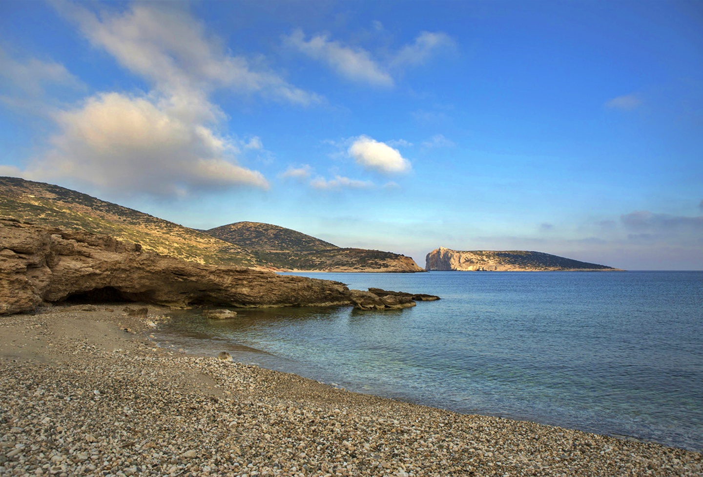
KALOTARITISSA BEACHES
Sapounochoma, Vlycho, Trypiti. Just when you think you have seen it all, this trio of beaches in Kaloratitissa, delivers the perfect finishing touch. The first two sit so close that swimming between them feels effortless, both nestled within the village. The third, Trypiti, is just a short 10-minute stroll away, waiting to be discovered.
And something for the end. Having so many beautiful beaches on such a small island is a true blessing. It would be a shame to leave without experiencing them all. But don’t worry, they’ll be waiting for you to return, with a shared promise: you’ll protect them from personal waste, and in return, they’ll reward you in the most magical way they know.